Safar

Getting your car ready

Safar

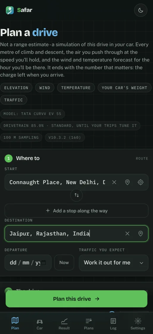
Plan a drive

Not a range estimate — a simulation of this drive in your car. Every metre of climb and descent, the air you push through at the speed you'll hold, and the wind and temperature forecast for the hour you'll be there. It ends with the number that matters: the charge left when you arrive.

ElevationWindTemperatureYour car's weightTraffic
Model: ready 1 km samplingv9.2 (112)
1

Where to

route
2

The drive

conditions

Leave traffic on Work it out for me and the app decides from your departure time — with a Google key it uses the delay Google measured for that hour, otherwise a rule of thumb from the clock. Override it if you know better than both.

Leave departure empty for now. Setting it matters more than it looks: the app fetches the temperature and wind for the hour you will actually be at each point, and a hot afternoon can cost several points of charge more than the same drive at dawn.

Chargers are off by default — the plan still tells you where you drop to your floor, what to charge to and where to look. Switch it on to have the app find and rank actual chargers, which adds a few seconds.

Speed comes from your driving style — gentle means both softer acceleration and a lower cruise. The router's own speed for each road still wins where it is lower, so nobody cruises at 82 km/h through a village.

3

How closely to look

optional

Your car

Pick a model to fill in weight, battery, drag and charge rate as a starting point. Every one of them stays editable, and your own figures always beat mine.

Model

specifications

Battery figures are usable capacity, not the nameplate number — a Curvv EV 55 gives about 52 kWh. Only the Curvv figure is confirmed; the rest are estimates, so correct yours if you know it.

On board

weight

No plan yet

Set a start and a destination, then plan the drive. The result lands here.

Plans you have made

Ten of them, kept on this phone. Opening one fetches nothing — it is drawn from what was saved, so it works with no signal, which is the state a phone is often in on the drive the plan was for. The chargers and the weather are as they were then; works it out again with today's.

Trip log

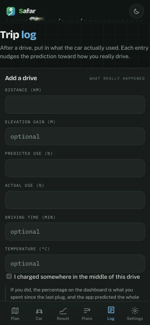
After a drive, put in what the car actually used. Each entry nudges the prediction toward how you really drive.

Add a drive

what really happened

History

makes the model yours

Settings

What this build can reach, and how it behaves.

About Safar

9.2

A simulation of this drive in your car — the climb, the air you push through, the weather forecast for the hour you will be there — ending in the charge you will have left when you arrive.

Every figure is an estimate. It has never seen your car, your right foot or the traffic on the day, and charger databases go out of date. Keep the safety margin, and check a charging stop before you depend on it.

Terms of Use — Safar

Last updated: 7 August 2026

These terms cover your use of the Safar app on Android and iOS, and the web version. By using the app you accept them. If you do not, please do not use it.

What the app is

Safar plans an electric-car journey. It simulates a specific drive — the climb and descent of the road, the air you push through at the speed you hold, the forecast temperature and wind for the hour you will be at each point — and tells you the charge you would have left on arrival, where you would drop to your floor, and where you could charge on the way.

What the app is not

Every figure it gives you is an estimate, and it can be wrong.

It works the drive out from physics and from figures you typed in. It has never seen your car, your right foot, your tyres, the state of your battery, the traffic on the day, or a road closure. It reads charger locations and availability from third-party databases which are frequently out of date, and it cannot know whether a charger will be working, free, or reachable when you arrive.

Treat it as a well-informed opinion, not a promise. Do not set off with less charge than you would be comfortable with if the app were not there. Keep a margin, and verify your charging stops independently before you rely on them.

The app is not a navigation system. It hands the route to Google Maps or OpenStreetMap for driving directions and takes no part in the drive itself.

Your responsibility

You are responsible for your own driving and for the decisions you make on a journey, including where and when to charge. Obey traffic law. Do not operate the app while driving.

No warranty, and the limit of our liability

The app is provided "as is", without warranty of any kind, express or implied, including fitness for a particular purpose. We do not warrant that it will be accurate, uninterrupted, or free of error.

To the fullest extent permitted by law, we are not liable for any loss, damage, cost or inconvenience arising from your use of the app — including a journey that took longer than predicted, a charger that was missing, broken or busy, or a vehicle that ran out of charge.

Nothing in these terms limits liability that cannot be limited by law.

Third-party services

To plan a drive the app contacts services run by other people — Google, Open Charge Map, OpenStreetMap and its Overpass and Nominatim servers, Open-Meteo, OpenRouteService, OSRM, Photon, and Amazon Web Services for terrain. Their data is theirs, their terms are their own, and we do not control what they return. Which service is used for what is set out in the privacy policy.

Map data from OpenStreetMap is © OpenStreetMap contributors, available under the Open Database Licence. Charger data from Open Charge Map is under its own licence. Google services are subject to Google's terms.

Advertising

The Android app shows a banner advertisement served by Google AdMob. What AdMob collects is described in the privacy policy. The iOS app carries no advertising.

Your data

There is no account and no login. What the app remembers — your trip log, your car settings, your saved plans — stays on your phone and is deleted when you uninstall it.

We run one service, which relays charger, search and routing requests to Google and caches the answers. It stores roads and chargers, not people, and it holds nothing that identifies you. Your logged drives are sent to it only if you switch that on yourself; the switch is off until you do. The privacy policy is the full account of both.

Our rights in the app

The app, its design and its source are © 2026 VoxHelper AI. All rights reserved. You may use the app; you may not sell it, pass it off as your own, or build a competing product out of it.

Third-party components carry their own licences, which are honoured.

Changes

These terms may change as the app does. The date at the top says when they last did. Continuing to use the app after a change means accepting it.

Governing law

These terms are governed by the laws of India, and the courts of India have jurisdiction.

Contact

Questions about these terms, the app, or a figure it gave you that looked wrong: support@voxhelperai.com


A plain-language note, outside the terms: this app was written because nothing existing would tell an Indian EV driver what a specific mountain drive would actually cost. It is honest about what it does not know, and the safety margin exists because the model is not perfect. Please use it that way.

Privacy Policy — Safar

Last updated: 8 August 2026

Safar ("the app") plans an electric-car journey: how much charge a drive will cost, where you drop to your reserve, and where you could charge.

There is no account and no login. We hold no data about you. The app does show ads, and it can ask for your location if you tap the button that needs it. Both are described below.

We do now run one service, and it changed one sentence this policy used to carry. Map, charger and routing requests used to go from your phone straight to Google; they now go through a relay we operate, which asks Google on your behalf. It is described in full under The service we run. It exists to keep our API key off your phone, and it stores roads and chargers — not people.

What stays on your device

Everything the app remembers is stored locally on the phone and never leaves it:

  • Your trip log (distance, elevation gain, predicted and actual charge used)
  • Cached terrain data, so a route you have planned before replans quickly
  • Your car settings and calibration figures
  • Your theme and data-source preferences

Uninstalling the app deletes all of it. None of it is backed up to us, and none of it is ever sent to us — the trip log included, unless you switch on the sharing described below, which is off until you do.

Your location

The Start field has a "use my current location" button. Nothing happens until you tap it. The app does not track you, does not read your location in the background, and does not read it at all unless you ask.

When you do tap it:

  • Android asks your permission first; you can refuse, and the app carries on working from typed place names
  • The coordinates are used to fill in the Start field and to plan the route
  • They are sent to the same mapping services listed below — the same way a place you typed would be — so that the point can be given a name and a road can be found from it
  • They are not stored anywhere except in the app's own local storage on your phone, and they are not sent to us

You can withdraw the permission at any time in Android's app settings.

What is sent to other services

To plan a drive, the app has to ask mapping services about the road. It sends the following, directly from your phone to those services:

SentToWhy
The place text you typeGoogle Places (through our relay), or Photon (Komoot)Turning "Manali" into a point
Start and destination coordinatesGoogle Routes (through our relay), or OpenRouteService / OSRMGetting the road between them
Coordinates along the routeOpen-Meteo, AWS Open Data (terrain tiles)Ground height and weather
Coordinates along the routeGoogle Places (through our relay), Open Charge Map, OpenStreetMap (Overpass)Finding chargers
Map viewport coordinatesGoogle Maps, or OpenStreetMap tile serversDrawing the map

Nothing is sent to these services that identifies you: no account, no name, no contact details. Your IP address is necessarily visible to them, as it is to any website you open.

Which service answers depends on the Where data comes from setting. The default sends map, search, routing and charger requests to Google, with the free services used as fallbacks when Google fails. Setting it to Free stops the app contacting Google for any of them.

Each service has its own privacy policy and its own logs, outside our control:

The Google API key used for those requests is ours, not yours — you are never asked for a key and billing for it never reaches you. The key for the map itself is built into the app, because the map library runs on your phone and talks to Google directly; it can do nothing but draw maps. The rest of the key lives on our relay, described next.

The service we run

Charger, place-search and routing requests go through a small service we operate, at `api.safarev.app`. It also answers on `safar.voxhelperai.com` and `safar-api.safar-app.workers.dev` — the same service, kept because apps already installed were built to reach it there. It runs on Cloudflare Workers, and the web app at `safarev.app` uses it too. Two reasons, and only two:

It holds the key. An app that calls Google directly has to carry the key inside it, where anyone can read it out and spend it. Ours now sits on the service instead.

It shares the answers. Chargers on a road are the same chargers whoever is driving it. One person's lookup answers the next person's, which is why the app can afford to ask Google for live free-bay counts at all.

What reaches it, and what becomes of it:

Reaches the serviceKeptFor how long
Coordinates of a stretch of road you are planning throughThe chargers found there, under a location rounded to a few km — not under you6 hours (bay counts, 15 minutes)
Start and destination coordinatesThe road between them, under those two points7 days
Place text you type in the search boxNothing
Your IP address, as with any web requestA request counter, under a one-way hash of the address that changes every minute2 minutes

There is no account, no identifier, no cookie and no log of who asked for what. The cache is keyed on places, not people: a stored entry says "there are four chargers near here", and there is nothing in it, or beside it, to say who asked. Requests are not linked to each other, so the service cannot assemble a journey even in principle — it never learns that the person asking about one stretch of road is the person who asked about the next.

Your IP address is visible to Cloudflare while a request is being handled, as it is to any website you open — https://www.cloudflare.com/privacypolicy/.

Checking that it is really this app. Before answering, the service asks Google to confirm that the app making the request is the genuine Safar from the Play Store and has not been repackaged. This uses the Play Integrity API. What it reports is about the app and the device, not about you: the package name, the signing certificate, whether Play installed it, and whether the device is a genuine Android one. No account, no advertising ID, and nothing you have typed is involved, and the result is a pass valid for a day which is not tied to any identifier of yours. It exists because the service spends real money on every Google lookup, and without it a copy of this app under another name would spend it — leaving real users without chargers.

Sharing your drives (off by default)

The Log screen has a switch marked Help fix the model. It is off. Turned on, each drive you log is sent to the service above, and it carries: the car, the distance, the height climbed, the temperature, the average speed, how many people were aboard, the air-conditioning setting, and the two percentages — what the app predicted and what the drive actually cost.

It does not carry where you started, where you went, when you drove, or anything that identifies you or your phone. Start and destination are the two facts about a journey that point at a person, and the physics has no use for either.

Why ask at all: the model is anchored on two drives taken from a published range test, and real drives across many cars, roads and seasons are the only thing that can replace them. Switching it off stops anything further being sent. Records already sent cannot be traced back and removed, because nothing in them identifies who sent it — which is the same property that makes them safe to send.

Advertising

The app shows a banner ad from Google AdMob. To serve it, AdMob collects information from your device independently of anything the app does:

  • Your device's advertising ID
  • Your IP address, and device and network information
  • Whether ads were shown, viewed or tapped

This is handled by Google, not by us. We never see it, and we cannot connect it to your routes, your trips or anything else in the app — the ad and the planner do not share data.

The Android build also carries the Privacy Sandbox permissions the ads SDK requires — `AD_ID`, and the Topics, Attribution and Ad ID access the Android advertising system uses. They arrive with the SDK; the app itself reads none of them.

Your choice about this. Before any advertisement is requested, the app asks through Google's consent platform. Where the law gives you a say — the EEA, the UK, and the American states that grant a right to opt out of sharing for targeted advertising — you are asked before the first ad, and you can change your answer at any time: Settings → About Safar → Advertising choices. If you say no, or if we cannot reach the consent service at all, no advertisement is requested.

The iOS build carries no advertising, no ad SDK, and no advertising identifier.

Analytics

There are none. The app collects no usage statistics and reports no crashes to us. We do not know how many people use it or what they do in it.

Links out of the app

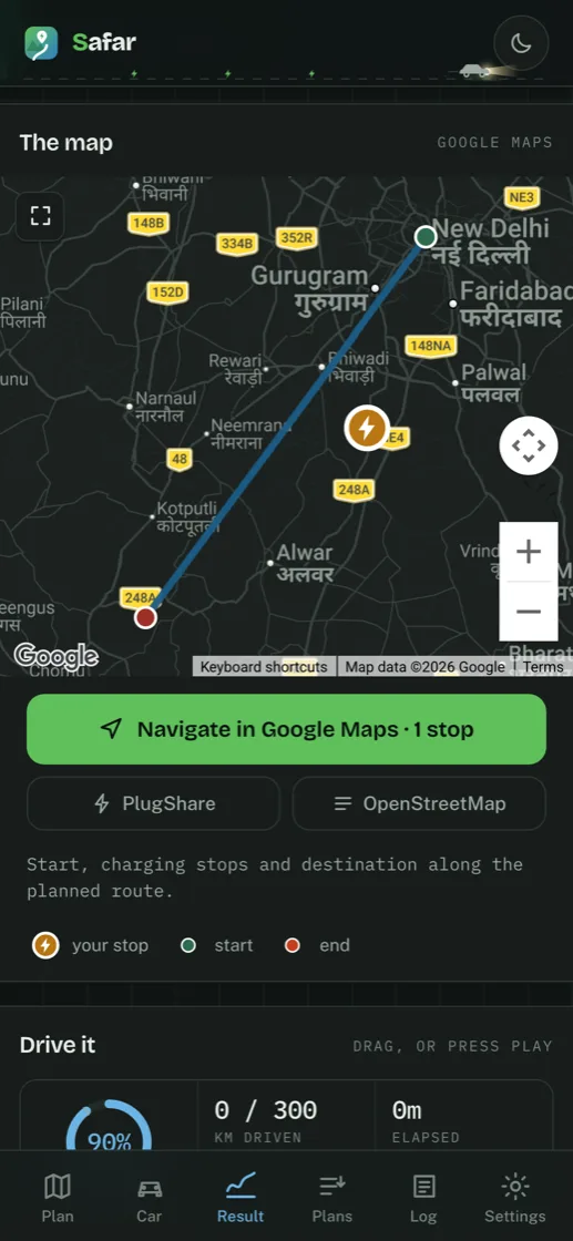
Buttons such as "Navigate in Google Maps", "Chargers on PlugShare" and "Open in OpenStreetMap" hand a set of coordinates to another app or website. Once you tap one, you are in that app and its privacy policy applies, not this one.

Fonts

The app loads typefaces from Google Fonts (`fonts.googleapis.com`, `fonts.gstatic.com`), which means your IP address is visible to Google when the app first opens. No key or identifier is attached.

Children

The app is a driving tool and is not directed at children.

Changes

If this policy changes, the date at the top changes with it, and the new version appears at the same URL.

Contact

Questions about this policy: support@voxhelperai.com

© 2026 VoxHelper AI · All rights reserved
Map data © OpenStreetMap contributors · Charger data from Open Charge Map
support@voxhelperai.com

This build

9.2
Version9.2
Build112
Dated2026-08-24
Chargers

Quote the version when you report something — it is the only way to tell which of these is on your phone.

Appearance

theme

Data sources

google or free

Leave this On. It is the default and what the app is tuned for: better place search for Indian town names, chargers that the open databases miss entirely outside the metros, star ratings and live free-bay counts where the network reports them, and a measured traffic delay instead of a guess.

Turning it Off uses only open data — OpenStreetMap, Open Charge Map, OpenRouteService. Everything still works and the physics is identical; you lose ratings, live bay counts, and chargers in thinly mapped areas. There is nothing to pay either way — this is not a paid tier, and no key of yours is involved.

Either way the app falls back on its own whenever a service is slow or unavailable, so a plan never fails for want of one.

Nothing about your drive leaves this device.
  • There is no account. Every calculation happens on this device.
  • Your trip log, calibration and cached terrain are written to this device's local storage and nowhere else. Uninstalling erases them.
  • Requests go to the mapping and charger services listed above and nowhere else.

Do not take our word for it — the whole app is one readable file: read the source.

Reverse place-naming always uses the free service: Google's Geocoding API refuses browser requests, so it cannot be called from here at all.

Under the bonnet

where the figures come from

The physics needs three things from a car: how much charge it really holds, what it weighs, and how hard it is to push through air. The first two are published. The third almost never is, so it starts as an estimate from the body shape — and an estimate from a shape is exactly the sort of thing that turns out wrong.

So where a car has been through a measured range test, that test is worked back through this model to find what it actually costs to move, and the difference is carried as a correction. Bigger than 1.00 means the car uses more than the shape suggests — heavy SUVs mostly do, and the largest here was out by a third.

Measured figures are from Autocar India's real-world range tests — their measurements, our arithmetic. Cars they have not tested carry 1.09, the middle of the ones they have, because most cars turn out to use more than the shape alone predicts and 1.00 would be a guess in the wrong direction.

None of this is as good as your own drive. Log one and the correction stands down — your car's own numbers replace the estimate for it entirely.

Two real trips in the same car fix the model. Trip A should climb; trip B should be flat. Driving time matters more than anything else here — the model needs the average speed each trip actually ran at, not the speed you held on the good bits.

What this build reached

no accounts, no card
Placesnot used yet
Routenot used yet
Mapnot used yet
TerrainTerrarium tiles · AWS Open Data
WeatherOpen-Meteo forecast
Chargersnot used yet

Filled in from the last plan you ran, so this is what the app reached rather than what it hoped to. The version is at the top of this page.

Planning your drive

Route, terrain, weather and chargers — fetched in parallel where they can be.